Your search returned 344 results
 Back To Search
31, and 33, Bank Street

1978
GL002523
Photographs
Photograph © T. J. Ermel

31, and 33, Bank Street
Reference No: GL002523
Photographs
1978
Bank Street numbers 31 to 33 and up the lane St Cuthberts Village. On the left is St Cuthberts Road rear also known as Lewis Street.
32-40, Gordon Street

1979
GL003846
Photographs
Photograph © T. J. Ermel

32-40, Gordon Street
Reference No: GL003846
Photographs
1979
340-360, Bensham Road

1986
GL002614
Photographs
Photograph © T. J. Ermel

340-360, Bensham Road
Reference No: GL002614
Photographs
1986
Near Sidney Grove
42-44, Bank Street rear

1980
GL002522
Photographs
Photograph © T. J. Ermel

42-44, Bank Street rear
Reference No: GL002522
Photographs
1980
57-29, Bank Street

1977
GL000175
Photographs
Photograph © T. J. Ermel

57-29, Bank Street
Reference No: GL000175
Photographs
1977
Ale Stores, Derwentwater Road

1980
SNO00286
Photographs
Photograph © T. J. Ermel

Ale Stores, Derwentwater Road
Reference No: SNO00286
Photographs
1980
Alexandra Terrace, Derwentwater Road

1980
GL000256
Photographs
Photograph © T. J. Ermel

Alexandra Terrace, Derwentwater Road
Reference No: GL000256
Photographs
1980
J. Smith chemist's and Exhaust Systems parts shops on Derwentwater Road. E. Ridsdale Fruiterer's is closed down at this time. Buildings date from 1850.
Alleyway at Trinity Square shopping centre

1995
LS000152
Photographs
Photograph © T. J. Ermel

Alleyway at Trinity Square shopping centre
Reference No: LS000152
Photographs
1995
Trinity Square and Gateshead Car Park were designed by Owen Luder in 1962. It was an example of Brutalist architecture. It cost £200,000 to construct and was opened on 2nd August 1969. Opinions regarding Gateshead Car Park have always been divided, nevertheless it achieved notoriety after appearing in the '70s film 'Get Carter'. In January 2008 this car park was closed and in 2010 it was demolished in order to regenerate Gateshead town centre.
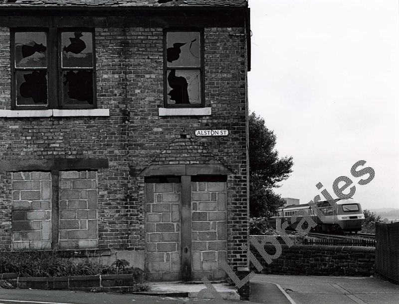
Alston Street ' Inter City 125' passing

1982
LS000674
Photographs
Photograph © T. J. Ermel

Alston Street ' Inter City 125' passing
Reference No: LS000674
Photographs
1982
Alston Street (Rear), Gateshead

1981
GL002374
Photographs
Photograph © T. J. Ermel

Alston Street (Rear), Gateshead
Reference No: GL002374
Photographs
1981
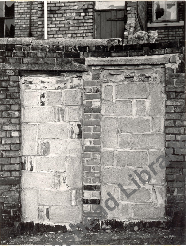
Looking north. Alston Street was situated next to First Street off Bensham Road. The lack of house-building during the First World War had caused a serious shortage of housing across Great Britain. In 1919 the Addison Acts required local authorities to assess housing needs and to built new houses for rent. In the 1920s new estates were built at Carr Hill, Bensham, Lobley Hill, Old Fold, Wrekenton and Deckham Hall. All houses were to have a scullery, larder, coal store, bath and indoor w.c. The new estates had wide streets lined with trees and were very different from the cramped terraces people were used to. The Council also had to address the poor housing conditions in the town centre. The worst areas were close to the river where overcrowding and risk of disease was at its worst. (Taylor, S. & Lovie, D. 2004) Under the Housing Act of 1930, the Council was given much greater legal power to deal with slum housing. The Act meant that whole areas of housing could be demolished and between 1932 and 1935 many of the streets in and around the town centre were acquired by compulsory purchase order and demolished. (Manders, 1973) House-building came to a stop during the Second World War and overcrowding in Gatesehead once again became a big problem. After the war the Council set to work building new estates at Highfield and Blue Quarries and later at Beacon Lough and Cedars Green. However, by the mid 1950s there was a serious shortage of traditional building materials and during the 1950s and 1960s concrete was used to build modern ‘high rise’ housing. The new building schemes were combined with a vigorous programme of slum clearance and by 1970s rows of terraces like Alston Street in Bensham, the Teams area and Central Gateshead had been demolished.
Alston Street, Gateshead

1981
GL002378
Photographs
Photograph © T. J. Ermel

Alston Street, Gateshead
Reference No: GL002378
Photographs
1981
Looking west towards Lobley Hill. Alston Street was situated next to First Street off Bensham Road. The lack of house-building during the First World War had caused a serious shortage of housing across Great Britain. In 1919 the Addison Acts required local authorities to assess housing needs and to built new houses for rent. In the 1920s new estates were built at Carr Hill, Bensham, Lobley Hill, Old Fold, Wrekenton and Deckham Hall. All houses were to have a scullery, larder, coal store, bath and indoor w.c. The new estates had wide streets lined with trees and were very different from the cramped terraces people were used to. The Council also had to address the poor housing conditions in the town centre. The worst areas were close to the river where overcrowding and risk of disease was at its worst. (Taylor, S. & Lovie, D. 2004) Under the Housing Act of 1930, the Council was given much greater legal power to deal with slum housing. The Act meant that whole areas of housing could be demolished and between 1932 and 1935 many of the streets in and around the town centre were acquired by compulsory purchase order and demolished. (Manders, 1973) House-building came to a stop during the Second World War and overcrowding in Gatesehead once again became a big problem. After the war the Council set to work building new estates at Highfield and Blue Quarries and later at Beacon Lough and Cedars Green. However, by the mid 1950s there was a serious shortage of traditional building materials and during the 1950s and 1960s concrete was used to build modern ‘high rise’ housing. The new building schemes were combined with a vigorous programme of slum clearance and by 1970s rows of terraces like Alston Street in Bensham, the Teams area and Central Gateshead had been demolished.
Alston Street, Gateshead

1982
GL002379
Photographs
Photograph © T. J. Ermel

Alston Street, Gateshead
Reference No: GL002379
Photographs
1982
Looking west, Dixon Street is behind the fence. Alston Street was situated next to First Street off Bensham Road. The lack of house-building during the First World War had caused a serious shortage of housing across Great Britain. In 1919 the Addison Acts required local authorities to assess housing needs and to built new houses for rent. In the 1920s new estates were built at Carr Hill, Bensham, Lobley Hill, Old Fold, Wrekenton and Deckham Hall. All houses were to have a scullery, larder, coal store, bath and indoor w.c. The new estates had wide streets lined with trees and were very different from the cramped terraces people were used to. The Council also had to address the poor housing conditions in the town centre. The worst areas were close to the river where overcrowding and risk of disease was at its worst. (Taylor, S. & Lovie, D. 2004) Under the Housing Act of 1930, the Council was given much greater legal power to deal with slum housing. The Act meant that whole areas of housing could be demolished and between 1932 and 1935 many of the streets in and around the town centre were acquired by compulsory purchase order and demolished. (Manders, 1973) House-building came to a stop during the Second World War and overcrowding in Gatesehead once again became a big problem. After the war the Council set to work building new estates at Highfield and Blue Quarries and later at Beacon Lough and Cedars Green. However, by the mid 1950s there was a serious shortage of traditional building materials and during the 1950s and 1960s concrete was used to build modern ‘high rise’ housing. The new building schemes were combined with a vigorous programme of slum clearance and by 1970s rows of terraces like Alston Street in Bensham, the Teams area and Central Gateshead had been demolished.
Armstrong Street

1991
SNO00317
Photographs
Photograph © T. J. Ermel

Armstrong Street
Reference No: SNO00317
Photographs
1991
Armstrong Street, Bensham

1987
GL002387
Photographs
Photograph © T. J. Ermel

Armstrong Street, Bensham
Reference No: GL002387
Photographs
1987
Armstrong Street looking west, taken from Saltwell Road.
Artwork entitled Field for the British Isles, at Gateshead railway works

1996
SNO00342
Photographs
Photograph © T. J. Ermel

Artwork entitled Field for the British Isles, at Gateshead railway works
Reference No: SNO00342
Photographs
1996
By Anthony Gormley
Artwork entitled Sports Day

1993
SNO00364
Photographs
Photograph © T. J. Ermel

Artwork entitled Sports Day
Reference No: SNO00364
Photographs
